Ica
This coastal desert department of sand dunes and sun, but also extremely fertile river valleys that provide sustenance for the local population is known particular as the country’s centre of production of Pisco, a Peruvian grape spirit. Agriculture is a way of live here, people grow grapes, butter beans, asparagus and citrus fruits. Many colonial haciendas still stand, though some in ruins, but the colonial systems of lords and peasants has since been broken, as has the use of slaves.
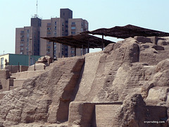
The region was home to some of the most important civilizations of Peru, such as the Paracas and the Nasca who of course left us the famous Nasca Lines – on the UNESCO World Cultural Heritage List as one of the world’s biggest archaeological mysteries. Ruins dot the region; pyramids, huacas, tambos and grave yards of Ancient Peruvians.
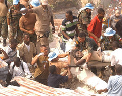
The Paracas Reserve and its natural coastal rock formations, many since destroyed by the earthquake of 2007, is refuge to fur seals, otters, penguins, dolphins and hundreds of species of birds, such as the flamingo.
Ica is also the home of Afro-Peruvian culture, descendents of slaves who have preserved their song, dance, and vigour for life.
My Blog
Earthquake 2007 (1,2,3,4)
The Huaca Centinela and the Chincha culture
Haciendas de Ica
El Carmen: Afro-Peruanos
Telmex destroys 2000 year old burial ground
Things to do and see
Ica and surroundings
Chincha
Nasca
Nasca lines
Palpa
Pisco – Paracas
Paracas
Maps
Map of Department
Detailed highway map
Plan of Ica city
Back to Top ^
Huancavelica
Huancavelica is known for having the roughest terrain in the country; gorges, mountainous peaks, winding valleys and mesas. The capital city. Huancavelica, is in one of the few easily accessible areas – a fertile valley of green pastures.
Huancavelica was home to the Waris and later by the aggressive Chancas. The area was then incorporated into the Inca Empire and became a military center. When the Spanish arrived, they discovered deposits of silver and mercury and began mining the area. There are many preserved colonial buildings from that time.
Outside of the city, mines and colonial churches are visitable in Santa Barbara, not to mention the obligatory archeological sites.
My Blog
Things to do and see
Huancavelica and surroundings
Huaytará
Angaraes: Lircay
Acobamba
Castrovirreyna
Maps
Map of Department
Detailed highway map
Plan of Huancavelica city
Back to Top ^
Cusco
The department of Cusco is home to the once Inca capital, Cusco. It is a land of fertile valleys and mountains dotted with ancient ruins. In the capital, a UNESCO World Heritage site, the remains of the Inca Empire are evident – there are ruins all around and many buildings are constructed on their foundations. The cobble-stone streets with Quechua names, lined with Inca walls lead to Inca temples and Spanish churches, often built on their destroyed remains.
When you are done walking the ancient streets, visiting Inca ruins and baroque churches, There are the artisans, bars and restaurants of San Blas area to visit. This picturesque district is also home to a number of hotels, which along with the bar and restaurants, are also built on Inca remains, or with Inca stones stolen from ruins.
Just outside of the city are the impressive, unbelievable even, ruins of Sacsayhuamán, with walls of intricately cut stones of many tones. Nearby are Qenko, Pukapukara and Tambomachay leading to the Sacred Valley of the Incas, with yet more ruins.
The towns of Písac, Maras, Chinchero, and Ollantaytambo, all dating from the time of the Incas are spread throughout the Sacred Valley, one hour from Cusco. Each has their own fascinating ruins and indigenous populations, often in traditional dress.
By far the main attraction in Cusco are the ruins of Machu Picchu, accessible by train for Machu Picchu or Ollantaytambo – or by hiking one of the Inca Trails, networks of pathways between snow-capped peaks, over rivers and through cloud forests.
The citadel of Machu Picchu, one of the 7 wonders of the world and Peru’s most important tourist attraction is also one of the few places in the Americas placed on both the World Cultural and Natural Heritage Lists by UNESCO. It sits on the top of a mountain, perched precariously, in the midst of a cloud forest. Visiting gives a real sensation of mystery and wonder.
My Blog
Inti Raymi
Qoyllur Rit’i
Chinchero
Rush to Ollantaytambo
Ollantaytambo ruins
Ollantaytambo town
Machu Picchu
Intihuatana
Huayna Picchu
Free custom tours of Machu Picchu
The Fog at the Sun Gate
Long Climb to Machu Picchu
Aguas Calientes
Pisaq – Inca Ruins
Pisaq – The market town
Problems with INC and Monopolistic Train Travel
Puka Pukará
Sacsayhuamán
Qoricancha – Templo del Sol
Monasterio de Santa Catalina
Quechua street names
Inca Q’osco
Cusco sells its soul to McDonalds, KFC and Starbucks
The Streets of Cusco
Cusco photos
God now charges by the hour
Cusco greed
Raqchi ruins
Pukará
Birdwatching in Peru
Streets of Cusco by Alan Malarkey
Things to do and see
Cusco and Surroundings
Acomayo: The 4 lakes route
Canas: Q’eswachaka Hanging Bridge
Canchis: Raqchi
Calca
La Convención: Quillabamba and Choquequirao
Paucartambo and the Tres Cruces lookout
Quispicanchi: Oropesa, Pikillacta and Andahuaylillas
Urubamba: Chinchero, Ollantaytambo and Machu Picchu
Machu Picchu
Maps
Map of Department
Detailed highway map
Plan of Cusco city
Back to Top ^
Madre de Dios
This deep jungle region is home to biodiversity unparalleled in the entire world. Infinite forests, wide rivers, heat and humidity and life everywhere you look. Madre de Dios is a land of indigenous Amazonian tribes and vast nature reserves.
Puerto Maldonado is the capital city, is the gateway to the Amazon, providing access to national parks. It was at one time an important city for exporting wood, rubber, gold and oil. Its economy now is based almost exclusively on eco-tourism. South of the city, along the river is the Tambopata-Candamo National Park of over 270,000 hectares, well know for being home to the greatest diversity of mammals, trees, insects, and bird species on the globe. Just outside of Puerto Maldonado one can find Lake Sandoval, and its swamplands, filled with orchids, kapok trees, caoba trees and Mauritanian palm trees that grow up to thirty meters tall. The lake is also the home to toucans, macaws, many varieties parrots, egrets, tapirs, turtles, and the refuge for river otters and black caimans, two species on the brink of extinction. Indigenous communities live out in the forest along the rivers, some open to receiving visitors.
The Manu National park of almost TWO MILLION hectares of primary virgin rainforest is home to 800 bird species, 200 mammal species, hundreds of plant species and many indigenous communities. Birdwatchers once broke a record here, seeing 324 species of bird in a single outing.
The only humid tropical savannah in Peru and one of the few in the world is found at the Bahuaja-Sonene National Park of over a million hectares, home to wolves, deers, anteaters, eagles, black caiman and river otters.
My Blog
Birdwatching in Peru
Petroglyphs of Pusharo
Things to do and see
Puerto Maldonado and Tambopata
Manu
Tahuamanu
Maps
Map of Department
Detailed highway map
Plan of Puerto Maldonado city
Back to Top ^
Arequipa
Arequipa consists of a dry desert coast and high Andes of snow-capped peaks and volcanoes, some overlooking the capital of the region, the city of Arequipa.
The capital is known as the White City due to its buildings being building with beautiful white volcanic sillar stone. Hanging over the city are the mountains Chachani, Misti, and Pichu Pichu. Central Arequipa, on the World Cultural Heritage list, is famous for its white buildings and beautiful colonial churches, convents and mansions. The famous Monastery of Santa Catalina is practically and 17th Century Spanish city in miniature with stone streets, beautiful patios, and plazas. Also the centre of the regions unique cuisine, a trip to a restaurant is not to be missed.
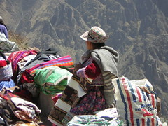
High in the mountains outside the city is the Colca Canyon, world famous as the deepest canyon on earth – until another nearby was proven to be even deeper. The area is home to condors and is covered with Inca farming terraces, still used today. The Collagua and Cabana cultures still exist in the region, keeping their tradition dress and customs despite conquer by the Incas and the Spanish, the later only able to influence them as far as outlawing skull deformation – a method they used to keep the two cultures separate.
My Blog
The White City of Arequipa
Founder’s Mansion
Molino de Sabandia
Rocoto Relleno
Puente Bolognesi
Puente de Fierro
Arequipa to Puno
Patapampa Reserve
Arequipa at Night
Miradores de Arequipa
Convent of Santa Catalina
Arequipa driving
Town of Maca
Cabanas and Collaguas
Town of Yanque
Colca Canyon
Cruz del Condor
Town of Chivay
Birdwatching in Peru
Renzo’s Story, new life in Arequipa
Ruins of Maucallacta
The Longest River in the World
Things to do and see
Arequipa and Surroundings
Colca Valley
Islay: Mejía Lakes
Castilla: Toro Muerto and Andagua
La Unión: Cotahuasi Valley
Caravelí: Puerto Inca
Camaná
Maps
Map of Department
Detailed highway map
Plan of Arequipa city
Back to Top ^
Puno
The department of Puno hugs the western shores of Lake Titicaca and slopes off into the jungle. The city of Puno, the capital, is a base from which to explore the lake, its islands, local ruins and the regions famous dances.
The lake area was territory of the Tiahuanacos, a pre-inca Aymara civilization, when it fell, the Aymaran descendents were conquered by the Incas. Both cultures, the predecessors and their decendents left and archeological legacy. The spectacular burial towers of the Chullpas de Sillustani lay a short distance outside the city, the ancient ruins of Pucará and dozens more sites spread throughout the area.
The Spanish were attracted my mining opportunities and the industry flourished here. The town of Juli is famous for its colonial churches and Lampa for its Vice-Royal church built between 1675 and 1685.
Puno is a cultural center of Peru and renowned as its folklore capital. With more traditional dances that anywhere else in the nation, and events such as the fiesta of the Virgin de la Candeleria. Buildings in the region are topped with the famous ceramic bulls, a tradition from Pucará and part of peoples beliefs.
On the lake’s islands live people who continue their traditional ways of life, as their ancestors before them. The floating man-made islands of Uros are and example of this, as are the simple lives of the people of Taquile, Amantaní and Suasi, known for their friendliness and hospitality.
My Blog
Virgen de la Candelaria, Puno’s Fiesta
The Yavarí
Puno city
Arequipa to Puno
The Uros: Floating Islands
Island of Taquile
Island of Amantaní
Our family and home on Amantaní
Chullpas of Sillustani
Birdwatching in Peru
Things to do and see
Puno and Surroundings
Chucuito: Juli and Pomata
San Antonio de Putina
Lampa and Pucará
Yunguyo: Wiñaymarka and Anapia Island
Melgar
Moho: Suasi Island
Maps
Map of Department
Detailed highway map
Plan of Puno city
Back to Top ^
Moquegua
Almost completely unvisited Moquegua is coastal and mountainous, with rich soils for agriculture. Life moves slowly here, with its year-round sunny climate. The capital of the same name is characterized by its traditional slanted-roof houses, its fountain in the central square designed by Gustave Eiffel (who also designed the tower in Paris) and its cathedral. It is also known for its production of fine Piscos.
The department as a whole has several small picturesque towns such as Torata with its impressive eighteenth century mills that still use stone to grind, its homes with slanted roofs. The port of Ilo, near where a sunken Spanish galleon was recently discovered, is the main industrial port of southern Peru. Beaches can be found, with caves, cliffs and rock formations.
My Blog
Things to do and see
Moquegua and Surroundings
Province of General Sanchez Cerro
Province of Ilo
Maps
Map of Department
Detailed highway map
Plan of Moqugua city
Back to Top ^
Tacna
This department, on the border with Chile and the main north-south crossing point is in what was Aymara territory, an ethnic people who still live here, and on the eastern side of Lake Titicaca into Bolivia.
There are reminders everywhere of the War of the Pacific, in which the invading Chileans defeated the Peruvian-Bolivian alliance and took large chunks of both countries. Alto de la Alianza monument and cemetery honor those killed in the invasion. As well as recent history, 1500 year old petroglyphs are found in the area, more than 500 of them.
Travelers heading to or from Chile cross the border here. Across into Chile is the city of Arica with connections throughout the country.
My Blog
Crossing from Chile to Peru
Lima-Santiago Direct
Things to do and see
Tacna and surroundings
Candarave
Tarata
Jorge Basadre: Locumba y Toquepala
Maps
Map of Department
Detailed highway map
Plan of Tacna city
Back to Top ^


![Dignity of a Nation [Featured]](http://farm4.static.flickr.com/3104/2701242503_dc1648891d_m.jpg)


