
Tumbes
Tumbes is known for its beautiful beaches, eco-systems of mangroves and its forests. More than 30% of the department is made up of protected areas. Tumbes is also known for having one of two main crossing points into neighboring Ecuador.
My Blog
Tumbes city
Getting to Huaquillas from elsewhere in Ecuador
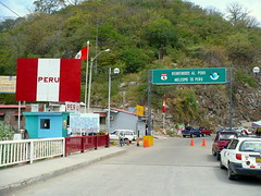
Getting to Ecuador via Huaquillas
Alternate Crossing avoiding Tumbes
Birdwatching in Peru
Things to see and do
Zarumilla: The Mangroves and the Tumbes Reserved Zone
Tumbes city and surroundings
Contralmirante Villar: Cerros de Amotape, Zorritos and Punta Sal
Maps
Map of Department
Detailed highway map
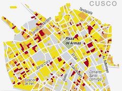
Plan of Tumbes city
Back to Top ^
Piura
Piura manly consists of sun-drenched desert and beautiful beaches, but here you will also find mountains and lakes. The coast features the largest desert in Peru, the Sechura. Towards the east, in the Andes, the terrain becomes rougher. The Porculla Trail is located there, (2138 masl / 7014 fasl); it is the lowest Andean trail in Peru.
Francisco Pizarro arrived in the area in 1530’s and founded South America’s first city in the Tangarara valley and called it San Miguel. The area served as Peru’s first port from which to ship the conquered Inca’s gold to Spain. Later, in 1588 Piura was founded in San Miguel’s place and the area and its Creole people flourished creating and perfecting their own foods, dance and subculture.
Just twelve kilometers from the city is Catacaos, famous for its artisans who work in straw and cotton. Also nearby is the town of Chulucanas, famous for its pottery.
The coast offers traditional fishing towns such as Colan, high end resorts, and popular beach towns such as Mancora.
In the mountains of Huancabamba, you will find the Huaringas and its shamans and an medicinal lakes.
My Blog
Piura city
Exquisite food in Esta es mi tierra
Los Tallanes and the ruins of Narihualá
Catacaos
Colán, fishing town
Tondero Piurano dance
Things to see and do
Piura city and surroundings
Sechura desert
Sullana: El Angolo and Poechos
Paita and Colán
Beautiful Beaches: Los Órganos, Máncora and Cabo Blanco
Morropón: Chulucanas and Vicus
Huancabamba: Las Huaringas
Ayabaca
Maps
Map of Department
Detailed highway map
Plan of Piura city
Back to Top ^
Lambayeque
Lambayeque is a coastal department, mostly arid with green valleys. The capital city Chiclayo is close to one of these fertile valleys and a major commercial center. From Chiclayo one can travel into the Andean departments of Cajamarca, Amazonas and San Martin.
The was Moche territory, a pre-Inca civilization who lived here between 100 and 500 A.D. making Lambayeque one of the most fascinating archeological centers of the country. Here you can find the famous royal tombs of Sipán, many extraordinary gold artifacts and the ruins of the great pyramids of the Lambayeque culture, more than 20. Its little wonder the area of the ruins of Túcume is referred to as Peru’s Egypt.
My Blog
Peru unveils 4000 year old temple
Chiclayo
Lambayeque
Señor de Sipán
Pimentel
The Sicán
Museo Nacional Sicán
Batán Grande – Bosque de Pomac
Túcume
The ruins of Zaña
Chaparrí
Ferreñafe
Things to see and do
Chiclayo city and surroundings
Lambayeque: Sipán, Túcume
Province of Ferreñafe
Tucume Archeological site
Batan Grande (Sican) Archeological Complex
The Royal Tombs of Sipán
Maps
Map of Department
Detailed highway map
Plan of Chiclayo city
Back to Top ^
Cajamarca
The department of Cajamarca is perhaps best known as the place in which the Inca Empire was all but ended. It was here that the Conquistador Francisco Pizzaro, not long after arriving in the region, encountered the Inca Emperor Atahualpa. After capturing him and holding him ransom, a ransom that was paid, Pizzaro murdered Atahualpa and began his bloody conquest. In the city of Cajamarca, visitors can see colonial constructions from the period of Spanish rule such as the Cathedral, the churches of San Francisco, Belen, and la Recoleta, mansions, and monuments all of which preserved.
From the times before the Spanish invasion, archeological sites include Inca Baths, the Ventanillas de Otuzco – a cemetery in a cliff face and Cumbemayo with its still functioning examples of Inca hydraulic engineering. The archaeological remains of Kuntur Wasi, a commercial centre more than 3000 years old offers visitors a climbs of the oldest gold objects found in the Americas.
The area, although Andean, is much lower than the rest of the country with more agriculture taking place. You’ll find it much greener.
My Blog
Cajamarca city
Cuarto del Rescate
Kuntur Wasi ruins
Sab Pablo – Chilete
Cumbe Mayo’s Mysteries
Ventanillas de Combayo & Otuzco
Carnival
People of Cajamarca
Yanacocha mine
Tantarica ruins
Conjunto Monumental Belén
Cerro Santa Apolonia
Baños del Inca
Dangers of Andean Travel
Things to do and see
Cajamarca and surroundings
Cutervo
Tabaconas Namballe National Sanctuary
Kuntur Wasi
Ventanillas de Otuzco
Maps
Map of Department
Detailed highway map
Plan of Cajamarca city
Back to Top ^
Amazonas
In the cloud forests of Peru’s Amazonas region is a charming city on the brow of the Andes where the mountains start their descent into the Amazon basin.
My Blog
Birdwatching in Peru
Things to do and see
Chachapoyas and surroundings
Bongará: Pomacochas and Chinata
Luya: Kuélap and Karajía
Bagua
Maps
Map of Department
Detailed highway map
Plan of Chachapoyas city
Back to Top ^
Loreto
By far the biggest department in Peru – more than 25% of the country, Loreto is also the least populated. In is covered in rainforest and divided by thousands of rivers, including the Amazon River, where water from each and every one of these thousands end up.
Iquitos is the capital, and the main port city on the Amazon River, and by far the largest in the Peruvian jungle. The area was first inhabited by indigenous tribes such as the Cocama, Huitoto and Bora who were converted to Christianity by Jusuit missionaries when they founded the city. In the 1800s Iquitos went through a massive economic boom fueled by the rubber industry and was home to some of the richest people in the country. Large colonial mansions can still be seen in the city, though most of the affluent have now left. Other examples of the city’s fame and wealth are the beautiful Palace Hotel and the Iron House, designed by Frenchman Gustave Eiffel of tower fame.
Elsewhere in the town, poverty can be found. The riverside neighborhood of Belen is built on poles and rafts, to protect them and river levels rise and fall each year.
As the largest Amazon region in the country, there are of course many nature reserves to visit. There is more that two million hectares of the Pacaya-Samiria Reserve, just 183km from the city and home to hundreds of animal species, such as the endangered Charapa turtle, Giant Otter, Black Caiman and dolphins.
The Allpahuayo-Mishana National Reserve is home to white sand forests, or varillales as they are known in the Peruvian Amazon rainforest. This also happens to be one of the best areas to go for bird-watching.
Loreto is also the best place to explore the Amazon River and its tributaries. Boat trips can be taken and sandy white beaches enjoyed.
My Blog
Birdwatching in Peru
The Kandozi
Peru Oil Find to make Peru an exporter
Half the Peruvian Amazon covered with oil leases
Suffering of uncontacted Amazon tribes
Things to do and see
Maynas, Iquitos and the Amazon river
Requena
Alto Amazonas: Yurimaguas
Contamana and surroundings
Ramón Castilla: Caballococha and Pevas
Pacaya Samiria and Allpahuayo Mishana
Maps
Map of Department
Detailed highway map
Plan of Iquitos city
Back to Top ^
La Libertad
La Libertad is a strangely shaped department ecompassing desert coast, mountains and jungle highlands. Trujillo is the capital city known for its cheerful people. The area was home to two important ancient civilizations, the Moche and the Chimú. The Chimú left behind a legacy of archeological sites including the UNESCO-lists mud city of Chan Chan, the largest such city in the world. Huanchaco, a town only 15 minutes towards the coast is famous for the means of pre-hispanic fishing conducted with Caballitos de tortora or reed boats that look like horses.
My Blog
Colonial Trujillo
Trujillo at Night
Sopa Teóloga
Huaca del Sol y de la Luna
The Cassinelli Museum
Huanchaco and the Caballitos de Totora
The Moche
The Chimu and the kingdom of Chimor
Chan Chan
Huaca Arco Iris
El Brujo complex
Emergency declared for Chan Chan
Things to do and see
Trujillo and Surroundings
Surf of Puerto Chicama and ruins of El Brujo
Huamachuco and surroundings
Santiago de Chuco
Ruins of Chepen
Otuzco
Pacasmayo and San Pedro de Lloc
Province of Viru
Huaca of the Sun and Huaca of the Moon (Pyramids)
Chan Chan ruins
Maps
Map of Department
Detailed highway map
Plan of Trujillo city
Back to Top ^
San Martín
San Martín is a land of jungle highlands and forests. The first Spanish city in the jungle was built here in 1549, called Santiago de los Ochos Valles de Moyobamba. It was from here that colonization efforts and religions orders spread out into the jungle. The city of Tarapoto is not far from the Huallaga river, where you can travel onwards to Iquitos or perhaps explore the department further by river.
The region is home to the Abiseo River National park, which itself is home to UNESCO World Cultural and Natural Heritage sites. The park contains 980 species of plant life, 220 species of bird and 47 species of mammal including jaguars and spectacled bears.
The famous and off-limits to most without permission ruins of Gran Pajatén are also located here in dense cloud forest; a city was built by the Chachapoyas people.
Other archeological sites are spread throughout the area and lagoons, rivers and waterfalls are located in their hundreds throughout the department.
My Blog
Things to do and see
Moyobamba and Surroundings
Rioja
Tocache
Gran Pajaten and Surroundings
Lamas
Laguna Azul and Ahuashiyaku
Maps
Map of Department
Detailed highway map
Plan of Tarapoto city
Plan of Moyobamba city
Back to Top ^
![Loosing weight in Peru [Featured]](http://farm4.static.flickr.com/3263/2894149292_88b26222f4_m.jpg)

![A Tango With My New Charango [Featured]](http://farm1.static.flickr.com/13/14395819_078370ba2e_m.jpg)